Stephen F Austin State Park

I made it out to my 16th Texas State Park this weekend. #16 was Stephen F Austin State Park off of I-10 just outside of Sealy, TX.

As with the other parks we’ve visited the Park Store staff were very helpful in planning our outing. We told them exactly what we had in mind for the quick trip to the park and they provided a couple of options that were just perfect.

We wanted a short hike and were directed to the overlook trail at the North end of the park. Park at the restrooms (seen below) and the trail head is on the opposite side of the park road.

restrooms across from trailhead

trail head at SFA state park

 There are several options from this starting point.

trees with vines on trail at sfa state park

We went to the right at the first fork, left at the next and followed the trail along to the Brazos River Overlook. (below)

brazos river overlook at sfa state park

Watch for snakes (we saw one) this time of year and carry lots of water. This was a beautiful park with lots of historical as well as natural features. I’ll follow up with a post on the historical features shortly.

Path tag from SFA State Park

Path Tags!

Along the way, my friends and I have tried to get something at each parks store that marks our visit to the park. Whether it’s a lapel pin, patch, etc. At some parks there are path tags. This is a really cool product that makes it easy to mark your visit to a park. You can just clip a ring to your pack and add tags as you go.

20130512-235650.jpg
Take a look at the parks store during your next visit and snag one of these cool path tags.

Government Canyon State Natural Area

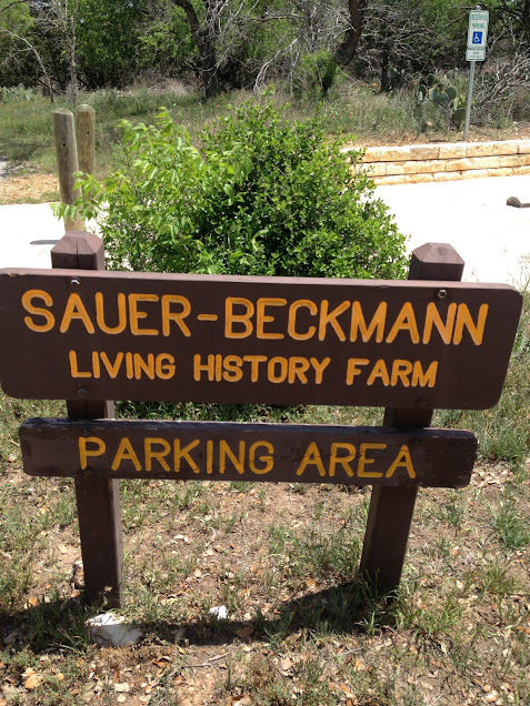
April 27th we visited Government Canyon State Natural Area.

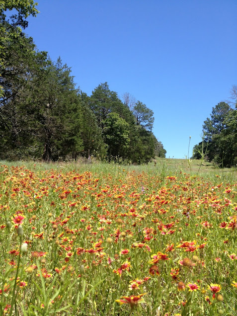
This relatively recent addition to the parks system is a combination of so many parks in Texas it’s almost too good to be true. There’s a prairie of wildflowers, canyon trails, lookouts to view the Texas Hill Country, Dinosaur tracks (yes, really), and much more.


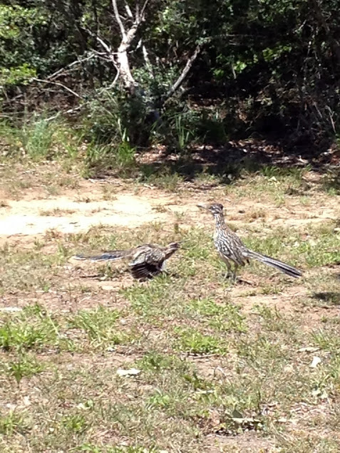
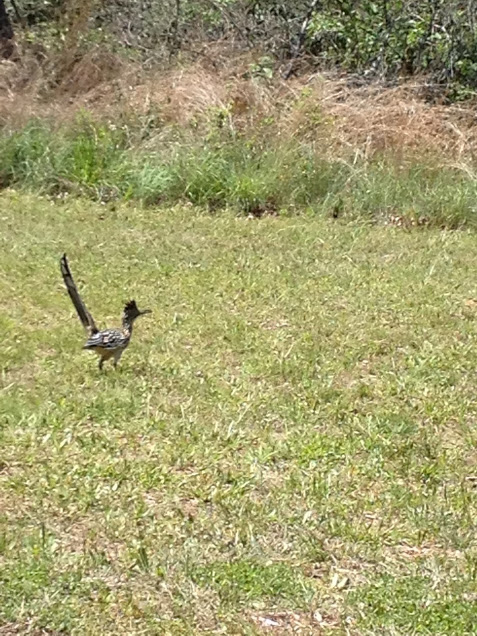
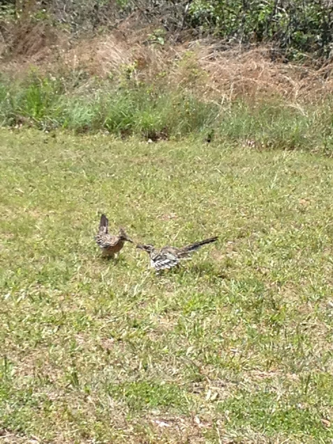
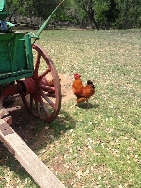
This is another park that you may encounter an unfriendly creature or two.

Mind the warnings and you’ll be fine. Oh and as the park ranger said, “Don’t pet or feed fluffy.”
The visitor from up north somewhere did not find that joke funny. I hope he remembered what she said though.

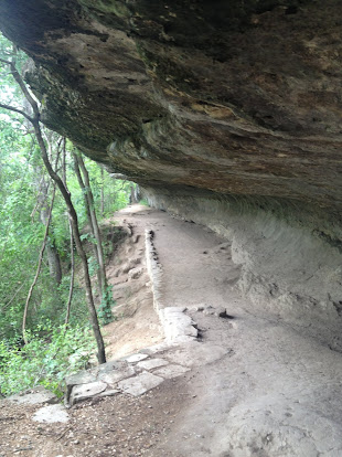
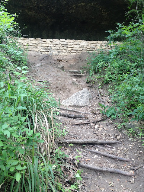
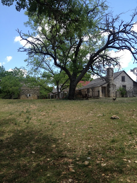
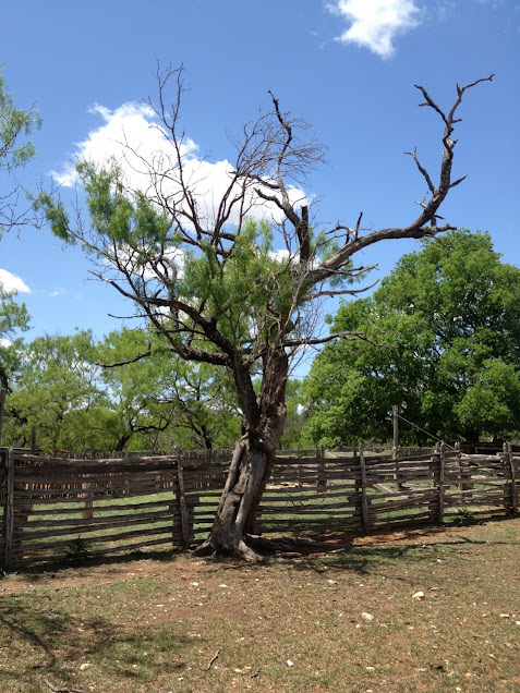
About two miles down the Joe Johnston route you’ll find a trail off to the left that leads to some old ranch buildings. It is rather snakey back in there so go at your own risk.


If you make it back to the path…just kidding
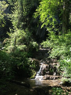
When you make it back to the path continue on down the trail, but keep an eye out for a relatively unused trail off to the other side of the trail.
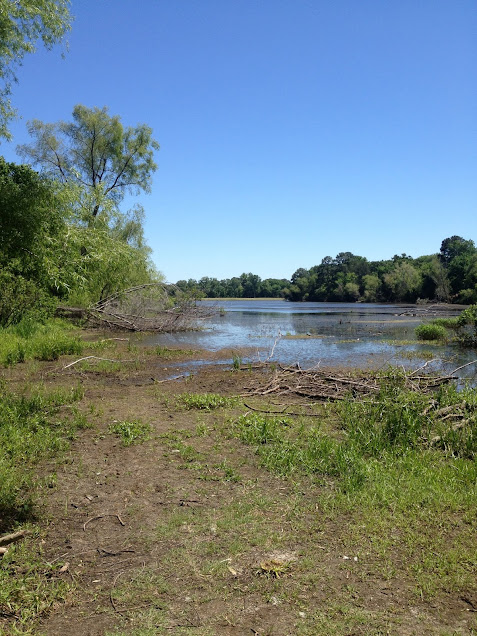
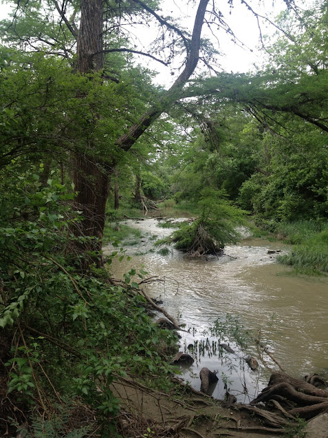
This path takes you down to a creek bed with some nice picture opportunities.

It was difficult to capture in the picture, but a lot of the vegetation is growing with the flow of the creek. Obviously this creek bed fills up with any rain so be careful and mindful of the weather on the day of your visit.

Keep going past Twin Oaks trail and Caroline’s loop and you’ll make it to the bottom of the bluff.

Here you’ll find many picture opportunities including dinosaur tracks.

I would go see these earlier rather than later as they are completely unprotected and will probably not stay this pristine for too long. Remember, this park was private land for many years and only so many people have had the pleasure of visiting the park. Around the tracks you’ll also see some blackberries, butterflies, trees/fern growing out of rocks…


and…a bee hive! (sorry, no pictures. It would’ve been blurry anyways as we were running at that point.)

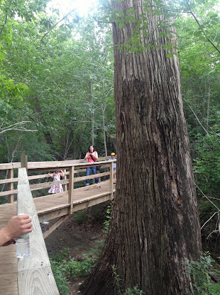
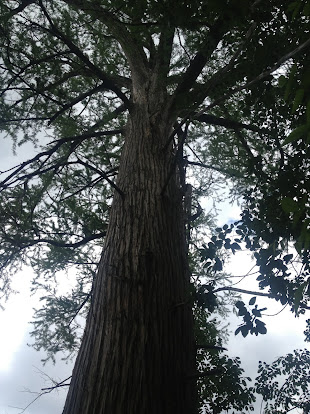
Continue on the trail up the hill and before you get to the Zizelmann Homestead you’ll see quite an amazing site.
Right in the middle of the park is a naturally occurring Spanish Moss growth that just takes your breath away.
You go from this:

to this:


(read the sign at the trees for more info)

Continue up the trail and you’ll see the Zizelmann House.

There’s not much to see as they’ve protected the house like it was some fossilized dinosaur…oh never mind.

If you follow the fence around the house and brave the steep trail down, past the spider webs, over the snakes, and…
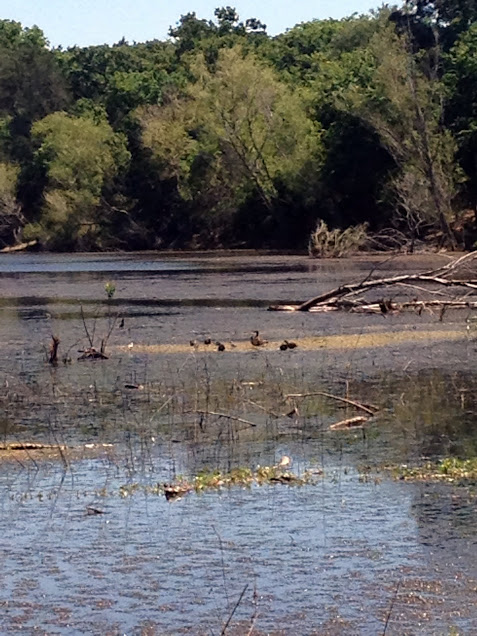
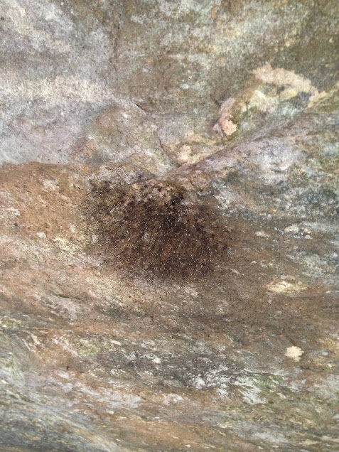
Wait. Let me me stop you here. Don’t risk it. It’s really not worth it. There are some springs at the bottom of the hill. You can’t see the spring though. You just see a nasty, still pool of water with bees (yes…again) and very little else. The spring is a sensitive area and you can’t/shouldn’t explore it too much. Again, take my word for it. It’s not worth a twisted/broken ankle.

This is the best picture I could get of it.

If you really want to see a nice spring flowing in a state park check out Pedernales Fall State Park and the Wolf Mountain Trail there.

Continue on up the trail and you’ll get to the top of the bluff. At the bottom of this is the dinosaur tracks. Take my word for it. Don’t look over the edge. Because of the angle, you have to actually lean out over the cliff to see the tracks. Just trust me, again, and know that they’re there.

Continue on Overlook trail until you get back to Joe Johnston Trail. Then you can head on back to the headquarters and parking. There’s no water along the trail and you can get lost if you’re not careful. We had a signal for most of the hike, but we were told of a story by the ranger that explained how important water can be. They recently had to send out a search party for a man who got away from his group and was lost for over 4 hours. There’s over 12,000 acres at this park and it’s easy to get turned around if you venture off the trail.

Another important reminder of this park is that sections of the park are only open for parts of the year.
The Protected Habitat area is only open from September to February. I’ll definitely be back here in September as there were pictures of caves, caverns, sinkholes, creeks, and more back at the headquarters. Maybe I’ll see you there.

Buescher State Park

Last Sunday, 5/5/13, I went out to Buescher State Park to try out the 7 mile loop trail.

Close to the parking area were these two:


It was a treat to see these two Greater Roadrunners out enjoying the weather.

Before heading to the trail, I checked out the lake.

There is a parking lot directly across from the trail head. There’s also a restroom close by.


This pipeline was covered in firewheels. Quite the surprise coming out of the forest.

Oh and when you get back to the parking area take a look at the old live oaks across from the parking.

One more thing. It is snake season. I encountered one on this trail and the rangers were sure to warn everyone at the store that they are out and about in the park because of the warmer weather. If you don’t carry a snakebite kit with you on your hikes, do yourself a favor and head to the nearest sporting goods store and pick one up. It’s one of those things you don’t want your family wishing you had with you. By then it’s too late.

McKinney Falls State Park (2nd try)

My friends and I decided to give McKinney Falls another chance. Maybe February just isn’t the best time to visit the park. After some much-needed rain and a different choice in trail I gained a new appreciation for the park. The wildflowers were blooming and it was nice and green.

We parked by the Smith Visitor Center and took the trail along the river, past the visitor center, and on to the rock shelter.

This massive tree was along the trail.

As you walk under the rock shelter used by the Native Americans so long ago take notice of the nests of spiders along the roof of the cave.

If you’re brave enough and the conditions are good take the path from the cave down to the river.

It is rather steep and slick so be careful. It was worth it for us though.

I’m glad we gave this park another chance. Hopefully some of the pending increase in funding from the legislature will make it to the other sections of the park.

LBJ State Park

Nestled out in the beautiful Texas Hill Country are two parks that illustrate what life was like for our 36th President Lyndon Baines Johnson (LBJ). I’m going to write about LBJ State Park in this post. I’ll follow up tomorrow with the National Park and the Texas White House.


The state park is west of Austin out on Highway 290 about 13 miles west of Johnson City. If you’re coming in from the East I recommend turning onto Park Road 1 and coming into the State Park from the North Entrance. It is a nice drive through the surrounding farms and sort of gets you in the mood for the park you are about to visit.

LBJ State Park is home to the Sauer-Beckmann Living History Farm.

picture of sign at road

This farm is a working farm operated by two volunteers. They dress, act, talk, and work the farm as if it was 1915. 1915 was a good year for the farm, but I’ll let them tell you that story.

If you have an hour or two hang out at the main house and listen to the stories. One of my favorite was when the couple explained what they do with the milk. Did I mention that the lady still milks the cow every morning? She also gets eggs from the chicken coop. Back to the milk. They have a good demonstration in the kitchen about how they don’t waste the milk. It’s used for various dairy products for the farm and they do it all by hand. Ask about the milk. You’ll thank me.

The couple uses the vegetables from the garden and the meat from the farm to feed the volunteers/park employees at lunch each day. So expect some traffic around lunch time, but it is nice to see what they are able to do with a 1915 kitchen. It really makes you think.

The pictures don’t do this park justice, but that seems to be the case with every park I visit.

Barton Creek Greenbelt

Off of the soap box and onto the trail. I’ve been sitting on this post for a busy couple of weeks. For those that have the pleasure of experiencing the Barton Creek Greenbelt you’ll agree with me that it’s an amazing escape from an even better city.

Less than two miles from the capitol there is a trail that takes you along the creek bed for more than 7 miles. Last Saturday we did the full trail; almost 15 miles. You can park at the Barton Springs Pool and start the hike there. The trail follows along the creek past Highway 360 and MoPac for about 7.5 miles. We park at the pool, hike to the end, and come back to get to the full 15 miles. Get there early and you won’t have to fight the crowds or walk miles just to get to the trail from your parking spot.

flowers at trail

trail in austin

water in barton creek

Luckily we had some rain in the preceding days and there was some water in the creek. Everything was really dark green and full of life.

creek

There are several places along the trail where you’ll encounter rock climbers of all talent levels. I don’t have any good pictures of the climbers from that day, but here’s a few of the rock faces along the trail.

rocks on trail

rocks on trail

How it all began…

An attempt to visit all of the Texas State Parks and Historic Sites

At some point in the fall of 2012 I messaged one of my good friends, “I think I’d like to visit all the state parks.”

Response: “I’m in.”

This site documents our story. Below is a list of the sites we’ve visited so far. There are blog posts on each park. I have personally been to some of them more than once so there are multiple posts about several of the sites. I hope you enjoy and I hope that our story inspires you to visit some Texas State Parks. There are some amazing treasures out there and the only way to experience them is to get our there and explore.

The main focus of my site is the attempt to visit all 93 parks. Several people have asked about a post that tells a little about myself or my story. Ask and you shall receive.

My name is John. I’m an 8th generation Texan and proud of it. I was born in the Houston, TX area and got to Austin as quick as possible. I went to the University of Texas at Austin and decided it was so great I’d never leave. I started working full time for the University and still hold a position today.

I’ve always enjoyed the outdoors. My dad would take me fishing at Lake Livingston State Park when I was 5 or 6 years old. I can vividly remember waking up and staring at the alarm clock waiting for it read 5:00 AM. I knew that would mean my dad would be coming to wake me up to take me fishing at the state park. That is my earliest memory of a state park, but there would be countless more to follow.

Shortly after my dad passed away, I joined the cub scouts where I met a family which would become somewhat of a surrogate family to me. Over the next eleven years they would include me in many of their family trips to state parks, national parks, or any number of other outdoors destinations. Not only did my love of the outdoors stem from this relationship, but this family was also responsible for me becoming a Longhorn. I can’t begin to put in words how important these people were in my life growing up and continue to be today.

In 2004 I enrolled at the University of Texas at Austin. A love of sports developed and I made it a point to see as many events as possible while a student. It has helped to fuel my passion that some of the greatest athletes in the history of Texas Athletics have come through while I have been on campus. Cat Osterman, Vince Young, Sanya Richards, Colt McCoy, Kevin Durant, Lamarcus Aldridge, Derrick Johnson, Brendan Hansen, Ian Crocker, Aaron Peirsol, Cedric Benson, Aaron Ross, Michael Huff, the list goes on…

Through various friendships and connections I met some of my closest friends today. Every fall we combine our love of UT Athletics, BBQ, and having fun and host tailgates for our friends and family. It was after one of these tailgates that I sent one of my friends the text.

“I’d like to visit all of the state parks in Texas”

Mother Neff State Park

On Saturday April 14th, 2013 my friends and I were out on another day trip on our quest to visit all 93 state parks. Originally we planned to do Colorado Bend State Park and then head to Abilene State Park. We spent a little too much time enjoying the treasure that is Gorman Falls and were forced to change plans.

Our detour led us to Mother Neff State Park. We headed to Belton from Lampasas, crossed over Lake Belton a couple of times and found ourselves at the first official state park of Texas. Like many of our state parks, Mother Neff has its own unique history.

Park Road 14 to get to the trails

We got a map at the temporary headquarters and headed to the trails. The park ranger at the office informed us that there will be a permanent headquarters opening soon so keep an eye out for sign directing you to the correct location if you head out to the park.

cave at mother neff state park

The park only covers about 25 acres so we were able to hike all of the trails in about 30 minutes or less. Even though it is small, the park has its treasures that need protecting just like most other parks. The first trail you encounter will take you to the cave that the Tonkawa tribe used as cover during buffalo hunts.

The next trail will take you back to the rock tower near the temporary headquarters.

The third trail will take you to both the prairie and the river basin and pond. Take the right fork to see the river basin and head to the cave. Take the left fork to head to the prairie and see the numerous wildflowers.

The park was a CCC project back in the 1930s and there are still numerous buildings standing from that time. When the CCC starting clearing land and excavating sites they found at least 3 Native American burial sites. I didn’t see where the sites were or even if they are marked. The CCC buildings appear to be in good condition. Those guys really did a great job of constructing long-standing structures.

structure at mother neff state park

Overall Mother Neff State Park was a beautiful park with lots to offer to every one who visits. I recommend it for a quick secluded hike. Join the park ranger for a guided tour on Saturdays from 2-3 pm.

Colorado Bend State Park

waterfall: gorman falls
Gorman Falls at Colorado Bend State Park

We headed out from Austin at 7:30 am to try and knock out more parks on our list of 93. On the agenda for the day was Colorado Bend State Park and Abilene State Park. We had Lake Brownwood as a “if we have time” destination for the way back to Austin.

Word of caution: Don’t use Apple Maps to get to Colorado Bend State Park. You’ll encounter a nice sign that warns you “don’t enter or else.”

We found the park using Google Maps about 9:30 am and headed down the road past Gorman Falls to find the park headquarters. The road into the park is unpaved but covered in rocky gravel. Any car can make it down the road fine, but you will need a car wash afterwards. About 6 miles down the road you’ll find a dreamy oasis with plentiful camping, a beautiful river, and the park headquarters. The restroom is 100 yds past the headquarters so if you are in need keep driving to the right and park closer to the restrooms.

Campground below bluffs next to Colorado River

The group unanimously decided that this was the most beautiful camping spots we’ve encountered on our state parks quest so far; nice camp area with spacious fire pits and tent spots, the slow moving Colorado River flowing close by, a bluff reflecting the morning sun hanging over the river, and a restroom close by.

park store
park store

tree

We headed to the park store to pick up a souvenir and get our permit. There’s a really cool tree outside that appears to be very old.

The staff inside was helpful though seemed like they may have needed more sleep or an extra cup of coffee. After getting our permit we headed back up the 6 mile unpaved, dusty road to head to our trail head to Gorman Falls.

The trail to Gorman Falls is about a mile from the parking area, but the closer you get to the falls the harder you’ll have to work to get there. “That escalated quickly” was a commonly held opinion among the members of our group.

rocky path
rocky path

I advise you to be careful, wear proper footgear and don’t pack too much for the last section of the hike. You’ll have to make some leaps of faith to get to the best view in the park. It is worth it and it is safe if you take it slow and think about your route down the steep, rocky path. The picture below is the beginning of the steep section of the path. It only gets more difficult from there. Hold onto the steel cables on the sides of the path. I don’t have any pictures of the more precarious section because I was a little distracted trying not to break my ankle.

The light at the end of the tunnel does shine brightly. When you make it down the rocky path you are rewarded with one of the most spectacular sights. “It looks like something out of a movie.”

I highly recommend the hike down to Gorman Falls. There is a self-pay station at the trail head for Gorman Falls. You don’t need to drive the 6 miles down the unpaved road to the park store if your only destination is Gorman Falls. Colorado Bend State Park is definitely a diamond among jewels in the state park system. It is one of my favorite so far and will defnitely be a camping and hiking destination for me in the years to come. Five stars all the way. (yes, even with the road)